

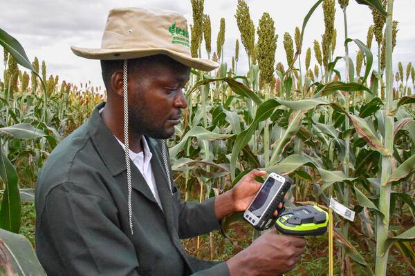
Photo by ICRISAT
The International Crops Research Institute for the Semi-Arid Tropics (ICRISAT) has brought together a collection of geospatial resources covering Asia and Africa on a new interactive platform designed to make spatial data more accessible to researchers and practitioners.
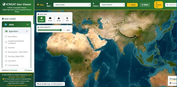
The platform, known as the ICRISAT Geo Viewer, consolidates geospatial products developed by ICRISAT’s Digital Agriculture and Geospatial Sciences team into a single online repository, giving users access to thematic maps, spatial datasets and multi-year geospatial layers covering diverse regions.
According to ICRISAT, the platform is intended to make it easier for scientists and other users to locate and apply existing geospatial resources rather than spending time and resources recreating datasets that have already been developed.
A single platform for geospatial data
The Geo Viewer brings together a broad range of geospatial products developed to support research and decision-making across agricultural and environmental systems.
The resources cover different geographical areas across Asia and Africa and include thematic maps, spatial datasets and geospatial layers generated over multiple years. By bringing these resources together, the platform provides users with a central point from which to explore spatial information relevant to their research and field activities.
The initiative forms part of ICRISAT’s broader work in digital agriculture and geospatial sciences, where spatial information and digital technologies are increasingly being used to understand agricultural landscapes, environmental conditions and resource-use patterns.
ICRISAT’s Digital Agriculture research focuses on using digital technologies, data and analytics to support more productive, resilient and sustainable agricultural systems.
Supporting agricultural and environmental research
The Geo Viewer is designed for users from a range of scientific disciplines, reflecting the increasingly interconnected nature of agricultural research.
Agronomists, for example, can use spatial information to better understand crop-growing environments, while climate scientists can draw on geospatial layers to examine environmental patterns and changes over time. Economists and natural-resource management specialists can similarly use spatial datasets to support analysis of agricultural systems, resources and landscapes.
The availability of multi-year geospatial layers is particularly valuable for research requiring comparisons across time. Rather than relying only on information representing a single point in time, researchers can use historical spatial information to examine changes and identify patterns that may inform agricultural planning and resource management.
Reducing duplication in research
One of the key benefits of the platform is its potential to reduce duplication of effort in scientific research.
Developing high-quality geospatial datasets can require considerable expertise, data processing and technical resources. When researchers cannot readily find existing datasets, they may have to repeat the process of collecting, processing and preparing similar information before beginning their primary analysis.
By making existing products accessible through a single platform, the Geo Viewer can help researchers move more quickly from data discovery to analysis and application.
This is particularly relevant in agricultural research, where researchers increasingly need to combine information from different disciplines and geographic areas to understand complex challenges such as climate variability, land and water management, food production and rural development.
Advancing digital agriculture
The development of the Geo Viewer comes as digital agriculture continues to expand the role of geospatial information in agricultural research and decision-making.
Satellite imagery, geographic information systems, spatial modelling and other digital technologies are generating increasingly large volumes of information about agricultural landscapes. Making these resources accessible and usable is therefore becoming as important as producing the data itself.
The platform also reflects a broader shift towards data-driven agricultural research, in which researchers can combine geospatial information with agronomic, climatic, socioeconomic and environmental datasets to develop a more comprehensive understanding of farming systems.
ICRISAT says its digital agriculture work seeks to leverage advances in digital technologies, including artificial intelligence, remote sensing, geospatial technologies and data analytics, to support agricultural transformation.
The ICRISAT Geo Viewer is available through the institute’s online mapping platform, providing researchers and practitioners with a central gateway to the organisation’s growing collection of geospatial products for Asia and Africa. ICRISAT Geo Viewer