Drones and targeted operations on crops were at the centre of a webinar promoted by the magazine Macchine Trattori and DronEzine, as part of the thematic events of EDP, the first virtual exhibition of agricultural machinery. During the meeting, space will also be given to the regulatory aspects related to the use of this technology in agriculture
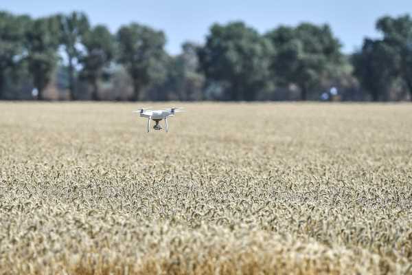
With the ever more widespread spread of agriculture 4.0 technologies, which is still under way, the use of drones in the primary sector has registered an exponential growth, especially for remote sensing applications.
This was discussed during the webinar promoted by the magazine Macchine Trattori and DronEzine, as part of the thematic in-depth analysis of EIMA Digital Preview, the first virtual exhibition of agricultural machinery. Entitled “Use of drones in agriculture”, the initiative included the participation of Jacopo Oldani, technical manager of Macchine Trattori, Stefano Orsi, scientific director of DroniEzine magazine, Paolo Martelli, brand manager of Attiva, and Alessio Bolognesi of FederUnacoma’s technical service. “In Italy – said Alessio Bolognesi, commenting on the various drone applications – there isn’t yet a full awareness of the great potential associated with the use of this technology in agriculture”.
Mapping the soil, analysing various types of soil parameters (in order to plan targeted treatments and processes), creating real radio links in areas that are not reached by a signal, coordinating machines that operate autonomously, and checking plant health, drones represent a powerful innovation factor for the primary sector.
However, as Bolognesi clarified, to fully exploit their potential we must change the approach to agricultural practices, and it is also necessary to have a thorough knowledge of the regulations governing their use. Current legislation distinguishes between non-specialized operations (recreational and sporting, for example) and specialized ones, which also include agricultural operations.
Using drones for agricultural uses – explained Orsi – requires a first pilot certificate for recreational and sporting activities, which can be obtained online. It must be paired with a second one, relating to specialized operations (including agricultural ones), which can be obtained in a training centre. All drones must be insured and registered, and cannot fly more than 120 metres above the ground – added Orsi. Furthermore, before take-off the operator must make sure that the area is not subject to restrictions.
The d-flight website shows the areas that can be overflown. While there is a single legislation for the entire industry, not all drones are the same from a technological and structural point of view. The different types of frame design, octocopter, fixed-wing, quad-prop – specified Martelli – affect the machine’s performance.
The most precise is the fixed-wing one, but the most popular on the market are octacopters and quad-propellers because they are easy to manoeuvre and control. Another variable to consider is the software used for mapping. For this type of operation – concluded the brand manager of Attiva – 2D and multispectral acquisition tools are used.
The latter are extremely important, since they allow to obtain very accurate information about plants and their health, which cannot be detected by the human eye. It is precisely on the basis of this information that the operator can intervene in a targeted and timely manner.


